Glacial Melt
Tuolumne River Area
Project: Tuolumne River Watershed
Simulate future low flows through Glacial Modeling

The Denman Glacier on Mt. Baker, Washington flows into the Middle Fork of the Nooksack River. A downstream dam and aqueduct divert water into Whatcom Lake, Washington. All of the glaciers on Mt. Baker have been receding, following worldwide trends.
Modeling the Denman Glacier provides projections of future low flows in summer when the fraction of total flows from the glacial melt is at its maximum.
Schedule Your HFAM Demo.
Glaciers have a zone of accumulation and a zone of depletion separated by a line of equilibrium. These zones and the line of equilibrium are dynamic, changing from year-to-year and over decades depending on climate trends (Figure 2).
Glacial ice flows by gravity across the line of equilibrium. When a glacier is stable, the accumulation of ice above the line of equilibrium balances the downgradient flow of ice across the line of equilibrium. Below the line of equilibrium, net glacial melt matches the ice flow across the line of equilibrium, and the toe of the glacier does not advance.
Glacial Segments are utilized to model glaciers. In each segment, snow accumulates and melts, and ice flows down gradient. A line of equilibrium is not preset but changes dynamically year to year.
Glacial ice forms by compression of the snowpack. Figure 3 shows processes in a high elevation segment of Denman Glacier.
The formation of ice balances the frozen ice outflow over the long term. Snow melts at this elevation (10,640 feet), and there is water yield from the snowpack in summer, but snowpack depths above the glacial ice remain a range from 80 to 150 feet.
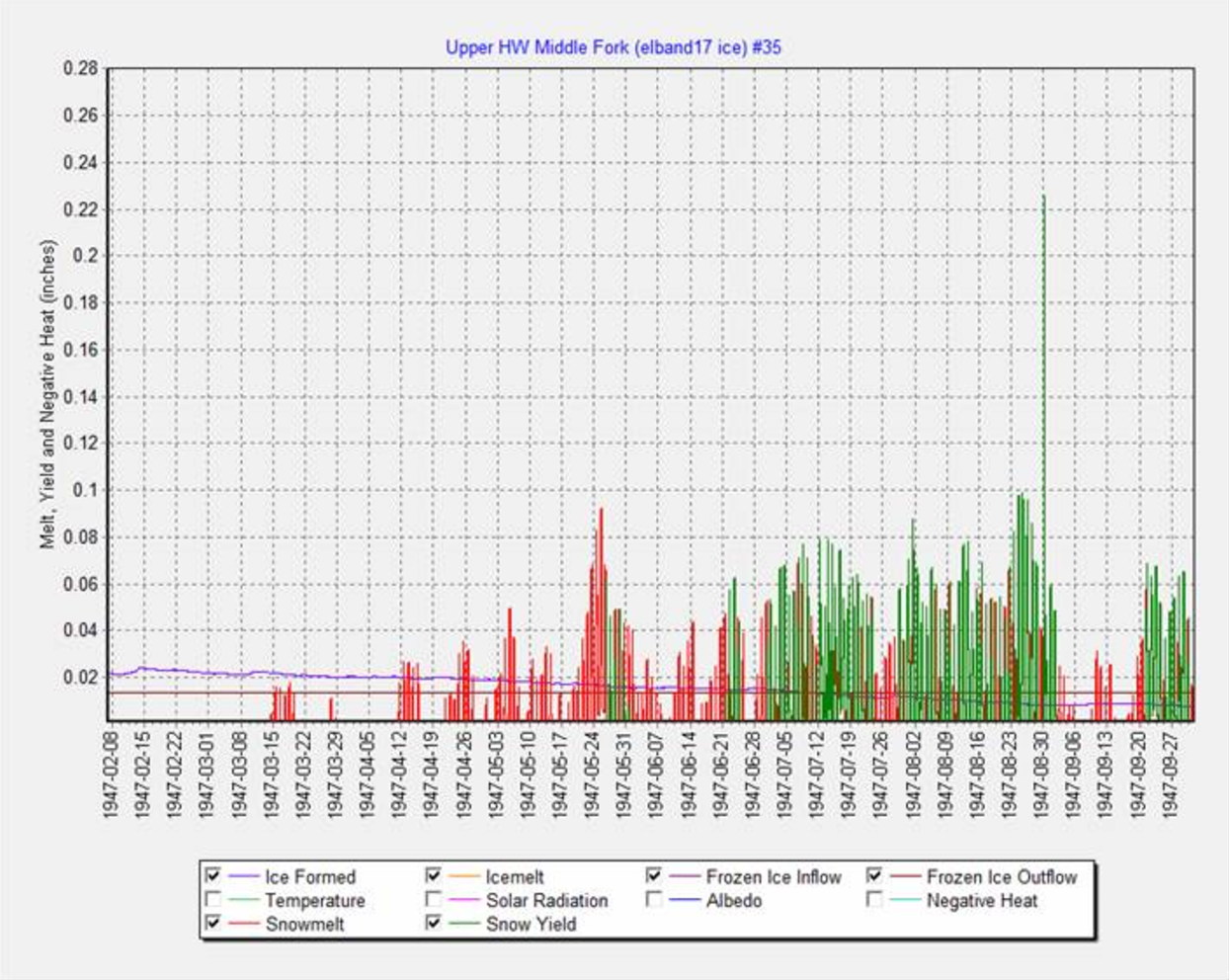
Figure 4 shows processes at a lower elevation, 4895 feet, in the zone of depletion. In the water year 1947, the snowpack on the surface of the glacier melts away July 11th.
The Denman Glacier model is finely balanced. Small differences in snow accumulation and air temperatures will cause the glacier to grow or deplete even though the long term trend since at least 1910 has been depletion. In the 1950s, several years of above average precipitation and snowfall caused the glacier to grow, and the toe of the glacier advanced.
What would happen to Denman Glacier if air temperatures increase? GCM projections average a 3 degree F increase by 2100.
Denman Glacier would not melt away entirely.
The line of equilibrium, now approximately 7500 feet, would move higher by about 1000 feet. The glacial accumulation zone rises to approximately 11,000 feet so some of the glacier would remain. Other glaciers on Mt. Baker have lower accumulation zones, and these glaciers could melt entirely.
Precipitation is another variable in the glacial growth or depletion. If climate change caused precipitation to decrease on Mt. Baker, glaciers would recede.


